
OAN Staff Cory Hawkins
4:03 PM – Tuesday, December 2, 2025
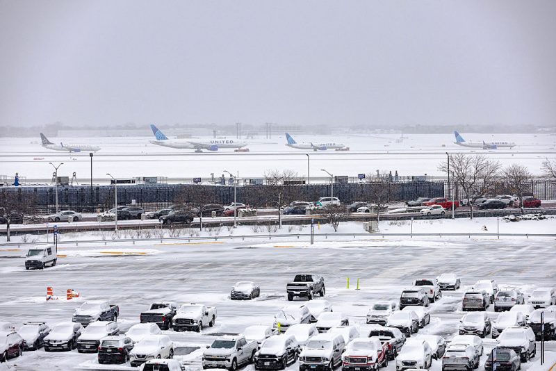
A powerful winter storm that has already blanketed the Midwest with several inches of snow is expected to intensify into a bomb cyclone, bringing even heavier snowfall across the region, meteorologists say.
Millions of residents from Ohio to Maine have been warned of the storm’s growing threat as it began moving into the Northeast on Tuesday morning.
Inland areas are reportedly receiving an inch of snow an hour.
The storm has the potential to transform to a bomb cyclone if pressure continues to plummet as it approaches the coast. This would likely result in bringing intense rain, winds, and snowfall to New York City.
A bomb cyclone is a term used by meteorologists to describe a storm undergoing bombogenesis, defined as a rapid intensification where central pressure drops at least 24 millibars in 24 hours. Winds have the potential to gust up to 50 mph, and often lead to white-out conditions.
The Weather Service advises that snowfall rates of at least an inch an hour can lead to significant accumulations.
Weather Impacts
Expect at least 3–6 inches of snow in parts of upstate New York, eastern Pennsylvania, and inland New England, with coastal areas like NYC, Philadelphia, and Boston seeing mostly rain or a brief wintry mix transitioning to rain. Freezing rain is possible in the Central Appalachians, creating icy roads. Winds could gust up to 50–70 mph along the coast, increasing flood risks from heavy rain.
The storm’s rapid intensification is causing slick roads, reduced visibility, and potential power outages. Hundreds of crashes were already reported in the Midwest earlier today as it moved east. Evening travel in the NYC metro area could turn chaotic due to the wet, slushy mess.
Forecast Timeline
Snow and rain peak this evening, tapering off overnight into Wednesday morning. Colder air follows, with below-freezing temps possible by Thursday.
“The rain vs. snow line is expected to come close to the Interstate 95 corridor,” said AccuWeather meteorologist Brandon Buckingham. “A slight shift in the storm track farther offshore could help to pull in cold enough air for snow to occur in places like Philadelphia, New York City and Boston.”
Stay informed! Receive breaking news alerts directly to your inbox for free. Subscribe here. https://www.oann.com/alerts
What do YOU think? Click here to jump to the comments!
Sponsored Content Below