
OAN’s Elizabeth Volberding
10:35 AM – Sunday, March 3, 2024
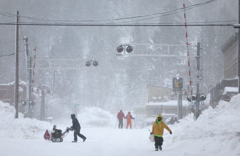
The National Weather Service announced that winter storm warnings for California’s Sierra Nevada are anticipated to remain in effect after Sunday as snow totals continue to rise by the hour.
Since Thursday, the Sierra Nevada area in California has been suffering from continuous blizzard conditions. As a result, a significant portion of Interstate 80 in California has been closed, and locals have been advised to seek shelter as severe wind gusts and heavy snowfall have put their safety in jeopardy.
According to the National Weather Service, there was a whiteout on Saturday that “made travel through the area impossible” due to over three inches of snow falling in the Sierra Nevada every hour and winds over 100 mph.
A second, “weaker” system is predicted to bring more snow on Monday, but for now, the massive blizzard that has dumped a ton of snow in the Sierra Nevada mountains will continue to pound the area through Sunday.
The storm, which lasted for several days and generated dangerous white-out conditions because of its strong wind gusts, closed national parks, ski resorts, and a portion of a major freeway in California.
High-elevation locations could see up to 10 feet of snowfall, posing a “life-threatening concern” to residents of Lake Tahoe and nearby regions, according to National Weather Service meteorologist William Churchill.
By Sunday night, the area is expected to get between five and twelve feet of snow, Churchill told the Associated Press. Higher elevations will likely experience more snowfall, while lower elevations will probably see a lot of rain.
Millions of people from California to Colorado are being affected by wind gusts exceeding 50 mph, even in regions with less snowfall.
With more blizzard and winter storm warnings expanding to the area of Northern California and Nevada, this is the greatest snowstorm of the season.
According to the weather service, there is a “HIGH to EXTREME avalanche danger” in the backcountry through Monday morning in the central Sierra slopes between Yuba Pass and Ebbetts Pass, which includes the larger Lake Tahoe area.
The primary highway connecting Reno and Sacramento, Interstate 80, still has “no estimated time of reopening,” according to a statement sent by the California Highway Patrol on Sunday morning.
Storm-related power disruptions affected thousands of customers in the blizzard-hit regions, as reported by Pacific Gas & Electric. As of Friday, there were still downed power lines on Interstate 80 and trees that had brought down power lines in the area, according to Dave Ebbert, a supervisor for the utility business operating in the Sierra region.
According to PowerOutage.us, as of Sunday morning, 14,700 power users were still without electricity throughout the whole state.
“We’re going to work diligently to keep the community and the public safe,” Ebbert said. “We’re going to restore power safely in the most timely manner possible.”
Stay informed! Receive breaking news blasts directly to your inbox for free. Subscribe here. https://www.oann.com/alerts